Browse the collection
 Image
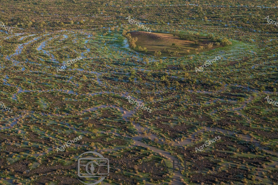
Aerial View of Channel Country Floodplains near Windorah, Queensland Serpentine waterways slice through an emerald and azure landscape, revealing the breathtaking hydrology of Queensland's remote Channel Country. Seasonal flood waters have transformed the arid terrain into a complex network of blue channels and verdant green vegetation, creating a mesmerizing mosaic of ecological renewal. A solitary vegetated island rises from the watery expanse, its golden-green trees standing resilient amid the liquid geography of this expansive pastoral region. The intricate water patterns demonstrate the cyclical life-giving power of seasonal flooding, crucial for sustaining cattle stations and native ecosystems in this harsh inland environment. Subtle variations of blue, green, and ochre merge and intertwine, showing how water reshapes the landscape, replenishing soil and supporting pastoral agriculture in one of Australia's most demanding agricultural zones. This aerial perspective captures the raw, elemental beauty of outback Queensland, where water is the primary architect of survival and regeneration.
 Image
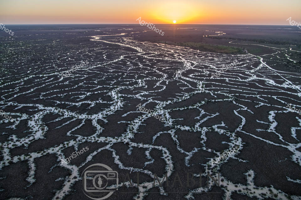
Liquid silver rivers fracture the dark earth at dawn, tracing delicate tendrils across the expansive Channel Country landscape near Windorah, Queensland. The aerial perspective captures the mesmerizing hydrology of a flooding waterway, its braided channels gleaming like mercury against the charcoal-dark floodplains as the first golden light crests the horizon. Each sinuous waterline reflects the sunrise, creating an intricate network of luminescent veins that pulse across the arid landscape, revealing the extraordinary natural irrigation patterns of this remote beef cattle station. The intricate water channels speak to the resilience and dynamic nature of Australia's inland ecosystems, where ephemeral rivers transform barren ground into potential pastureland during seasonal floods. Soft gradients of amber and slate stretch to the distant horizon, capturing the raw, elemental beauty of Queensland's remote inland regions. This breathtaking landscape represents the lifeblood of pastoral Australia - water, transforming marginal lands into productive agricultural environments.
 Image
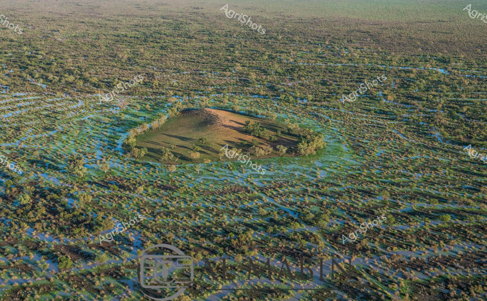
Aerial vista of Channel Country in Queensland during peak flood season, a mesmerizing landscape of interconnected waterways and verdant floodplains stretching to the horizon. A solitary elevated landmass—likely a cattle station's strategic high ground—emerges like an island sanctuary amidst the expansive blue-green aquatic terrain. The intricate network of water channels weaves between sparse vegetation, creating a mosaic of azure and olive hues that characterize this unique Australian inland ecosystem. Seasonal flooding transforms the arid landscape into a dynamic, life-sustaining environment, critical for supporting cattle grazing and native biodiversity in this remote region. The subtle undulations of the terrain reveal the complex hydrology of Channel Country, where water becomes the defining element of survival and agricultural potential. This breathtaking aerial perspective captures the raw, untamed beauty of Queensland's inland waterways, showcasing the resilience and adaptive nature of Australia's agricultural landscapes.
 Image
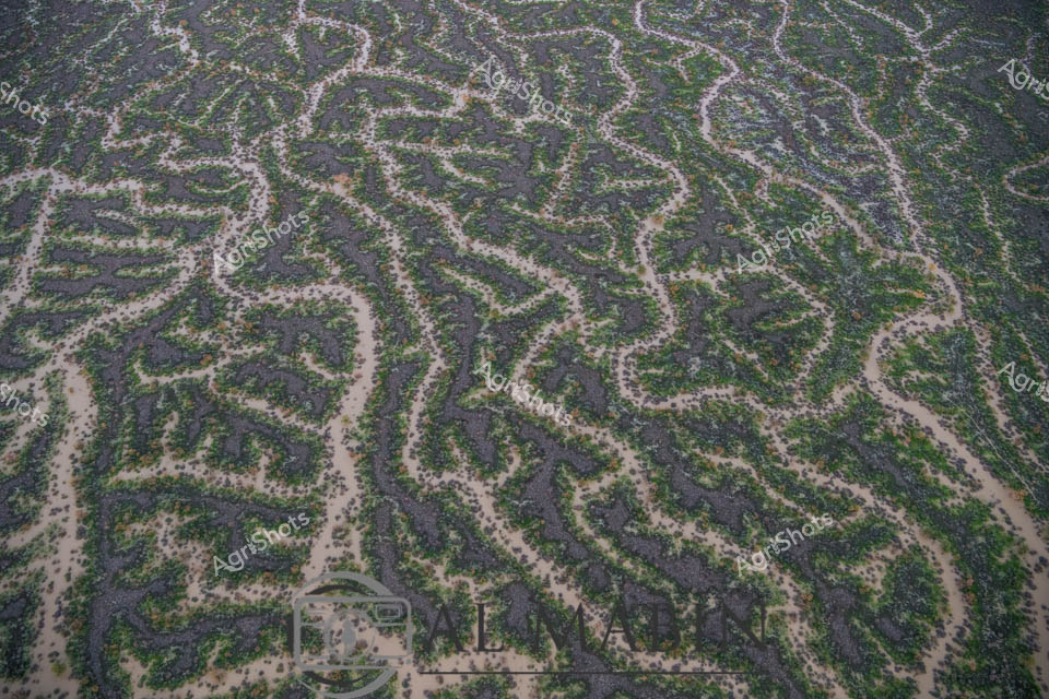
Aerial view of a mesmerizing floodplain near Windorah in Queensland's Channel Country, where intricate water channels weave across the landscape like delicate silver veins. The serpentine waterways create a complex network of green and grey, revealing the dynamic hydrology of this arid region during a significant flooding event. Sparse vegetation lines the sinuous channels, highlighting the stark contrast between the sandy earth and the life-giving water that transforms this typically dry landscape. The meandering streams demonstrate the incredible natural irrigation patterns that sustain pastoral stations and support cattle grazing in this remote Queensland environment. Each twist and turn of the water channels tells a story of resilience, showing how these inland ecosystems adapt to extreme seasonal variations. The aerial perspective captures the breathtaking complexity of Australia's inland water systems, where every curve represents the delicate balance of water, soil, and sparse vegetation in one of the continent's most challenging agricultural terrains.
 Image
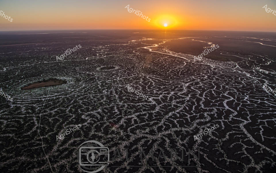
Sunrise bathes the intricate waterways of Channel Country in a golden light, revealing the mesmerizing network of braided river channels stretching across the arid Queensland landscape. The aerial perspective captures the delicate, lace-like patterns of water threading through the dark earth, creating a stunning natural mosaic that defines this unique pastoral ecosystem. As the sun crests the horizon, its warm rays illuminate the complex hydraulic system that sustains life in this remote beef cattle production region. The waterways - likely Cooper Creek or a similar inland river system - demonstrate the critical importance of water management in Australian agriculture, showing how these ephemeral water networks support extensive cattle stations during both flood and drought conditions. The intricate branching channels reflect the resilience of the landscape, with each silvery stream potentially representing a lifeline for cattle grazing in this challenging environment. This breathtaking vista encapsulates the raw beauty of Queensland's inland pastoral zones, where water is the most precious resource in a seemingly inhospitable terrain.
 Image
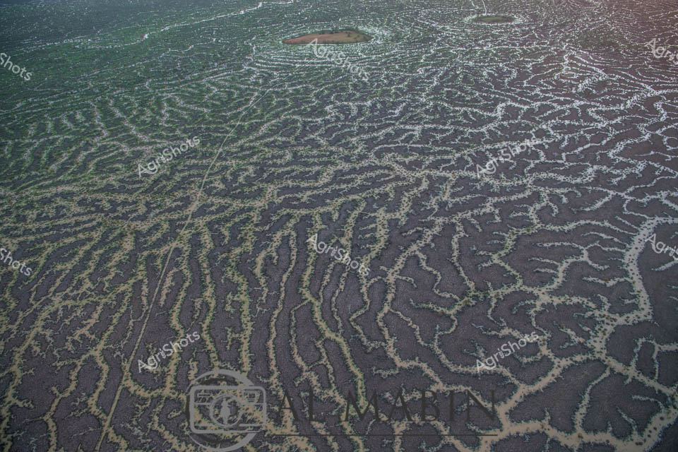
Aerial view of intricate water channels spreading across an arid Queensland landscape, capturing the mesmerizing patterns of flood irrigation in Channel Country. Sinuous lines of water weave through dark and green-tinted earth, creating a natural labyrinth that resembles delicate veins across the barren terrain. The complex network of waterways reveals the transformative power of seasonal flooding, where ephemeral rivers and creeks spread nutrients and moisture across the harsh outback landscape. Subtle gradients of green, brown, and grey blend together, showcasing the delicate balance of water management in Australia's remote beef production regions. This extraordinary perspective highlights the resilience of pastoral landscapes, where strategic water distribution enables livestock grazing in some of the continent's most challenging environments. The image captures the raw beauty of Queensland's inland hydrology, where every water channel represents a lifeline for agricultural survival in an unforgiving ecosystem.
 Image
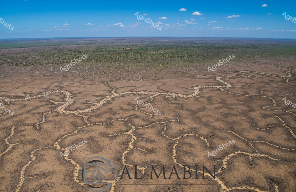
Serpentine waterways carve intricate patterns across the arid landscape of Queensland's Channel Country, revealing the delicate hydraulic infrastructure of station. Aerial perspectives showcase the complex network of ephemeral creek channels, their pale edges contrasting against the ochre and dusty brown earth, creating a natural irrigation system that sustains this remote beef cattle pastoral region. The intricate branching waterways resemble delicate veins across the landscape, capturing the precious moisture essential for survival in this harsh Australian outback environment. Distant green vegetation marks the edges of the floodplain, while a bright blue sky with scattered white clouds offers a sense of expansive tranquility and timeless geological process. This remarkable image captures the nuanced relationship between water, land, and pastoral agriculture in one of Australia's most challenging yet productive agricultural landscapes. The natural drainage patterns demonstrate how strategic water management enables cattle production in an environment where every drop of water is a lifeline.
 Image
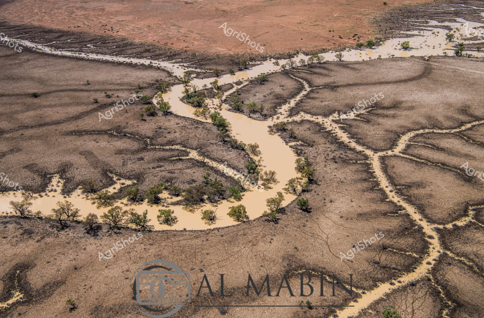
Serpentine channels of milky-tan water wind through the parched ochre landscape of Channel Country, revealing the lifeblood of this remote Queensland pastoral ecosystem. A network of ephemeral waterways branches across the arid terrain, lined with resilient remnant trees clinging to the saturated banks during a rare flooding event. The aerial perspective captures the intricate hydraulic arteries that define this harsh yet dynamic agricultural landscape, where water transforms the dusty expanses into a temporary network of life-sustaining corridors. Sparse vegetation and weathered earth tones dominate the scene, punctuated by the sinuous, almost organic flow of water that reflects the region's extreme seasonal variations. This is the raw, unfiltered essence of Australian beef station hydrology - a delicate dance between aridity and sudden abundance, where every drop of water represents survival and potential for pastoral enterprise.
 Image
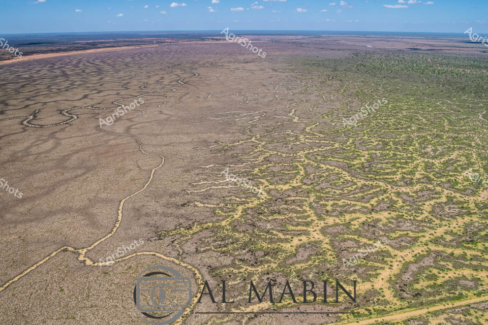
Aerial vista of Channel Country in remote Queensland, revealing the intricate natural water management system of an expansive cattle station. Sinuous waterways carve delicate, serpentine paths across an arid landscape, creating a mesmerizing network of silvery-brown channels that gradually transform the terrain from dusty grey to mottled green. The image captures the extraordinary resilience of this harsh inland ecosystem, where ephemeral creek systems bloom with subtle vegetation during rare flooding events, supporting critical pastoral operations. Soft blue skies stretch across the horizon, highlighting the immense scale of this agricultural landscape where water is the most precious resource. The winding channels demonstrate nature's engineering - gradually distributing scarce moisture across seemingly inhospitable terrain, enabling sparse but tenacious vegetation to emerge in intricate patterns. This breathtaking perspective from Al Mablin station showcases the complex hydrology of Australia's inland regions, where cattle stations must work in profound harmony with the unpredictable rhythms of water and land.
 Image
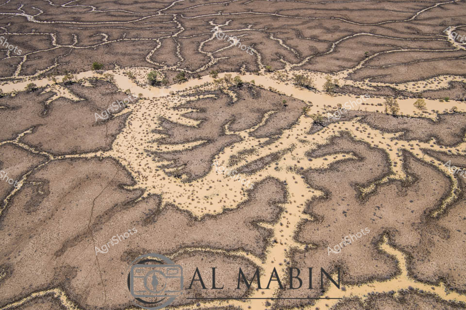
Aerial watershed mapping reveals the intricate hydrology of Channel Country in remote Queensland, where ephemeral creek systems snake across arid landscapes like delicate silver veins. Sandy-colored flood channels spread in mesmerizing fractal patterns, capturing the transient water movements that sustain this harsh inland ecosystem. Sparse vegetation clusters along the lighter sandy ridges, contrasting against the weathered brown earth, demonstrating the remarkable resilience of desert flora. The waterways, etched into the landscape like ancient arteries, illustrate the complex hydrology that supports pastoral operations in this challenging environment. The photographic documentation captures the subtle beauty of Australia's inland water systems, revealing how these seemingly barren terrains pulse with intricate life-sustaining networks during rare flooding events. The image is a testament to the geological and ecological sophistication of Queensland's remote beef station regions, where water management is critical to survival.
 Image
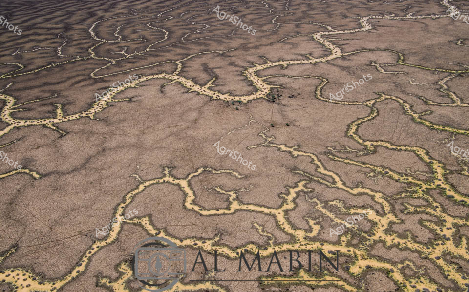
Meandering waterways carve intricate golden-edged channels across the parched earth of Queensland's Channel Country, revealing the dramatic hydrology of Australia's arid interior. Delicate ribbons of yellowed vegetation trace the ephemeral creek lines, highlighting the complex networks that carry precious water across this harsh landscape during rare flooding events. The aerial perspective transforms the landscape into an abstract topographical map, showcasing the resilient ecological patterns of inland Australia's beef station territories. Windorah's distinctive landscape emerges as a masterpiece of natural engineering, where water navigates through sun-baked terrain in serpentine patterns that speak to the region's extreme environmental conditions. These seasonal water flows are lifelines for remote pastoral operations, providing critical hydration for livestock and sustaining sparse vegetation in one of the continent's most challenging agricultural environments. The muted browns and subtle golden highlights capture the raw beauty of Queensland's inland watersheds, illustrating the delicate balance of survival in Australia's unforgiving outback.
 Image
Aerial vista of Channel Country in western Queensland, revealing the intricate hydrology of an arid pastoral landscape. Sinuous waterways in silver and pale blue meander across a mottled terrain of earthy browns, soft yellows, and sage greens, creating organic, interconnected patterns that speak to the delicate water distribution systems of this harsh inland region. The expansive floodplains demonstrate the complex ecological networks of inland Australian waterways, where seasonal flooding creates temporary life-giving corridors across seemingly barren landscapes. Sparse vegetation clusters along the water channels, highlighting the resilience of plant life in this challenging environment. The horizon stretches endlessly, broken only by subtle variations in terrain and vegetation, capturing the immense scale and raw beauty of Queensland's remote beef station country.
 Image
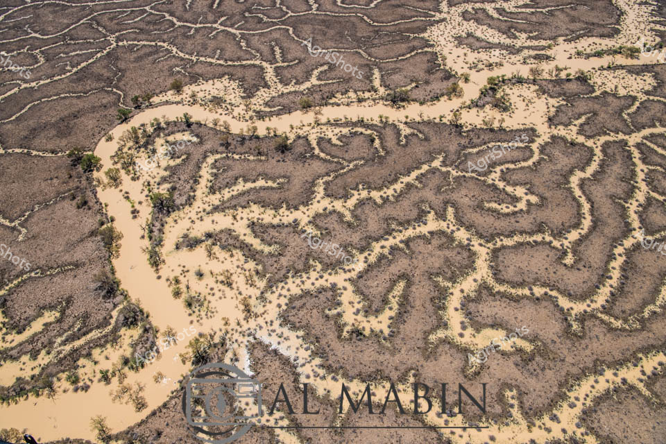
Serpentine waterways slice through the parched Channel Country landscape, revealing the intricate hydrology of Queensland's remote inland region. Murky sandy-colored floodwaters wind between drought-scorched earth, creating sinuous channels lined with sparse, resilient eucalyptus and acacia trees. The aerial perspective captures the delicate network of ephemeral creek systems that are vital lifelines for pastoral stations during rare flooding events, transforming the arid terrain into a complex hydraulic mosaic. Pale sediment-laden streams contrast dramatically with the burnt sienna and charcoal tones of the surrounding landscape, highlighting the dynamic seasonal transformations of this harsh yet beautiful inland ecosystem. These waterways represent critical infrastructure for beef cattle stations, providing essential water resources across thousands of square kilometers of remote Australian outback. The image powerfully illustrates the challenging environmental conditions that define agricultural operations in Queensland's most extreme pastoral zones, where water management is crucial for survival.
 Image
This aerial image captures an intricate network of waterways and channels winding through arid terrain, typical of Queensland's Channel Country. Sandy-colored water pathways snake between dark earth and sparse vegetation, creating a complex, maze-like pattern that reveals the dynamic hydrology of this remote landscape. The natural water distribution system demonstrates the resilient ecosystem of Australia's inland regions, with intermittent vegetation highlighting the delicate balance of water and land in this harsh environment.
 Image
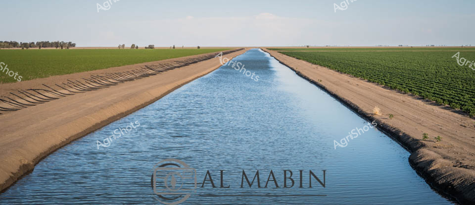
Precision irrigation transforms arid landscape into verdant agricultural abundance in this striking agricultural vista. A meticulously engineered water channel cuts a pristine blue pathway between lush green crop fields, revealing the critical infrastructure of modern farming. Sandy earthen banks frame the carefully constructed water conduit, highlighting the calculated engineering required to sustain agricultural productivity in challenging environments. The expansive horizontal landscape suggests a region like New South Wales, where water management is crucial for crop survival. The symmetrical irrigation canal represents the essential lifeline connecting water resources to agricultural production, symbolizing human ingenuity in transforming challenging terrain into productive farmland.
 Image
Sunrise bathes the ancient Kimberley landscape in molten gold, transforming rugged rocky outcrops into burning terracotta formations against a soft blue dawn sky. Weathered boabs and native trees dot the verdant grasslands, their gnarled silhouettes creating a timeless pastoral scene characteristic of Western Australia's remote northern regions. The dirt track winds through the foreground, suggesting the vast pastoral stations that define this harsh yet beautiful agricultural frontier. Soft green grasses carpet the ground, hinting at recent seasonal rains that breathe life into this typically arid landscape. The panoramic vista captures the raw, elemental beauty of station country - a testament to the resilience of agricultural life in one of Australia's most challenging yet breathtaking environments. This image embodies the spirit of the Kimberley: untamed, magnificent, and quietly powerful.
 Image
Sunlight blazes across the expansive cotton fields of northwestern New South Wales, casting long shadows as a farmer surveys the precision-irrigated landscape. Neat rows of vibrant green cotton plants stretch to the distant horizon, intersected by carefully constructed irrigation channels flowing with water. A flexible black poly pipe follows the contours of the raised earth beds, delivering critical moisture to the developing crop. The farmer, dressed in a bright blue work shirt and deep burgundy shorts, stands surveying the meticulously engineered agricultural landscape, his stance reflecting generations of agricultural knowledge and careful land management. In the background, a distant utility vehicle hints at the mechanized nature of modern cotton farming in the Walgett Shire region. The scene captures the intricate balance between human intervention and natural growth, showcasing the sophisticated water management techniques essential to successful cotton production in Australia's challenging agricultural environments.
 Image
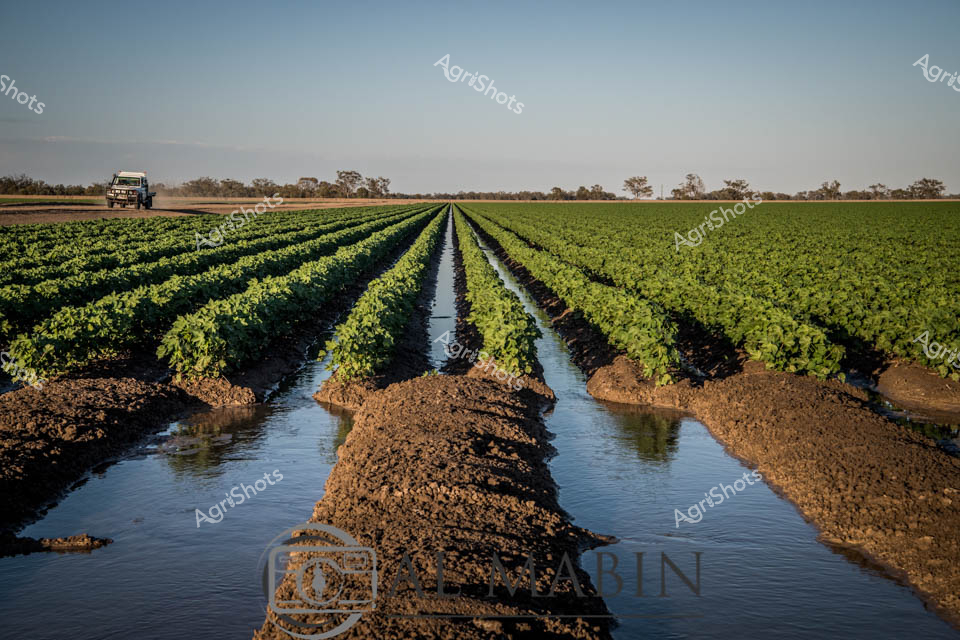
Verdant cotton rows stretch across a fertile agricultural landscape under a pale dawn sky in rural New South Wales. Precision irrigation channels flow between meticulously planted green crop rows, creating a geometric pattern of rich brown earth and reflective water channels. A rugged utility vehicle sits distant on the horizon, suggesting active farm management and the scale of modern agricultural operations. The carefully engineered irrigation system demonstrates sophisticated water management techniques, with raised crop beds allowing controlled water distribution to nurture the developing cotton plants. Cool morning light bathes the scene, highlighting the vibrant emerald foliage against the textured soil, capturing the delicate balance between agricultural technology and natural growth. This expansive view epitomizes Australian cotton farming - a testament to agricultural innovation in challenging environments, where strategic water use and careful cultivation transform arid landscapes into productive agricultural ecosystems.
 Image
Blue-clad agricultural workers orchestrate a critical irrigation moment along a precise cotton field channel near Walgett, New South Wales. Sleek black poly pipes arc across the rich, dark earth, delivering water through a rhythmic siphon technique that sends a dramatic spray skyward against the vast blue horizon. The team, dressed in matching blue work shirts and shorts, demonstrates the precision and teamwork required in modern cotton farming, their stance confident and synchronized as they manage the water flow. Sculpted agricultural landscape stretches to the distant horizon, revealing the meticulous engineering of Australian dryland farming - transforming arid terrain into productive croplands through strategic water management. Each team member plays a crucial role in this hydraulic dance, manipulating the irrigation infrastructure with practiced expertise that speaks to generations of agricultural innovation. The bright midday light and clear sky emphasize the crisp, industrial beauty of contemporary agricultural practice, where technology and human skill combine to nurture fragile crops in challenging environments.
 Image
Emerald fields of cotton stretch to the horizon beneath a pale dawn sky, bisected by an irrigation channel where a green and yellow John Deere tractor meticulously shapes the earth. The machine's powerful form straddles the water channel's edge, its blade carefully contouring the soil with precision characteristic of modern agricultural engineering in northern New South Wales. Golden-rimmed wheels and a robust front loader create striking geometric lines against the russet-brown irrigation bank and the verdant crop rows beyond. This quiet moment captures the sophisticated dance of farming technology and natural landscape, where every movement is calculated to maximize water efficiency and crop potential in the challenging Walgett Shire region. The early morning light casts long shadows, emphasizing the tractor's deliberate positioning and the careful management of water resources critical to cotton production. Crisp lines of cultivated earth contrast against the smooth water surface, revealing the intricate choreography of agricultural sustainability.
 Image
Parched earth splits and fragments beneath a lifeline of vibrant green saplings, revealing the stark resilience of agricultural regeneration in an arid Australian landscape. Deeply fissured clay soil, bleached to a steel-blue grey, creates a cracked mosaic reminiscent of drought-stressed terrain, with young plants emerging along the edges of what appears to be an irrigation channel or agricultural drainage line. Brilliant emerald-lime foliage bursts from slender stems, creating a powerful visual contrast against the brittle, desiccated ground - a metaphor for agricultural persistence in challenging environmental conditions. The image captures the delicate balance of water management and crop survival, typical of cotton-growing regions in New South Wales where every drop of moisture is precious. Poly pipes, partially visible, hint at the sophisticated irrigation infrastructure supporting plant life in this unforgiving landscape. This photograph embodies the spirit of Australian agricultural innovation - finding hope and growth in the most challenging terrain, where resilience is measured in green shoots and careful water distribution.
 Image
Agricultural irrigation team orchestrates a precise water distribution technique along a cotton field's levee bank near Walgett, New South Wales. Four workers in matching blue shirts coordinate their movements, manipulating long poly pipe siphons to transfer water methodically across the dry, rich brown soil. Crisp blue sky stretches overhead, suggesting a clear autumn or late summer morning with optimal irrigation conditions. Each team member expertly angles a siphon, creating arcing streams of water that cascade precisely into the carefully constructed irrigation channels beside a freshly planted crop row. Their synchronized movements reflect years of practiced skill, demonstrating the technical finesse required in modern agricultural water management. The landscape reveals a quintessential Australian agricultural scene - flat, expansive farmland with geometric precision, where advanced irrigation techniques transform arid terrain into productive agricultural real estate.
 Image
Rural irrigation specialists adjust water flow along a precision-engineered agricultural channel, orchestrating the vital liquid's distribution across a verdant cotton field. Dressed in coordinated blue work shirts, the agricultural technicians stand atop a meticulously constructed earthen irrigation bank, manipulating a poly pipe siphon that arcs a dramatic spray of water across the dry landscape. The crisp azure sky and expansive, flat agricultural terrain of what appears to be a New South Wales cropping region frame their methodical water management technique, highlighting the critical role of strategic irrigation in Australian agricultural productivity. One worker, positioned at the pipe's end, gestures and controls the water's trajectory with practiced expertise, while his colleagues monitor the flow and distribution. The scene captures the precision and technical skill required in modern agricultural water management, where every droplet is carefully calculated to maximize crop yield in a challenging, arid environment. Rich brown soil, vibrant green crop rows, and the dynamic blue of the workers' uniforms create a compelling visual narrative of agricultural innovation and landscape transformation.
 Image
Sun-drenched cotton fields stretch across the landscape near Walgett, revealing the precision of agricultural irrigation in New South Wales. Four farm workers in vibrant blue tops carefully navigate the narrow earthen banks between verdant green crop rows and murky irrigation channels. Poly pipes snake along the ground, delivering critical water resources to the meticulously planted cotton fields through carefully engineered siphon systems. The geometric patterns of brown tilled soil and emerging green crops create a striking visual rhythm, highlighting the calculated science behind modern agricultural production. Early morning light casts long shadows, emphasizing the linear geometry of the landscape and the measured movements of the workers managing this essential water distribution. The scene captures the intricate dance between human labor, technological innovation, and the demanding environment of Australian cotton farming, where every drop of water is a precious resource carefully managed to sustain crop growth.