Browse the collection
 Image
Sun-drenched cotton fields stretch across the landscape near Walgett, revealing the precision of agricultural irrigation in New South Wales. Four farm workers in vibrant blue tops carefully navigate the narrow earthen banks between verdant green crop rows and murky irrigation channels. Poly pipes snake along the ground, delivering critical water resources to the meticulously planted cotton fields through carefully engineered siphon systems. The geometric patterns of brown tilled soil and emerging green crops create a striking visual rhythm, highlighting the calculated science behind modern agricultural production. Early morning light casts long shadows, emphasizing the linear geometry of the landscape and the measured movements of the workers managing this essential water distribution. The scene captures the intricate dance between human labor, technological innovation, and the demanding environment of Australian cotton farming, where every drop of water is a precious resource carefully managed to sustain crop growth.
 Image
Straddling precision-planted rows of young crops, a gleaming green John Deere tractor navigates a meticulously cultivated agricultural landscape near Walgett in northwestern New South Wales. The massive agricultural machine bears an oversized yellow warning sign, highlighting its substantial width as it traverses the carefully ordered fields. Crisp morning light illuminates the intricate geometry of parallel crop rows, creating a mesmerizing pattern of rich earth and vibrant green seedlings stretching to the horizon. The tractor's advanced irrigation system extends broadly, suggesting sophisticated water management techniques critical to farming in this arid region. Dust and moisture drift softly around the vehicle, capturing the delicate balance of technology and nature in modern Australian agricultural practice. This powerful image encapsulates the high-tech precision of contemporary cotton farming, where cutting-edge machinery and strategic crop management transform challenging landscapes into productive agricultural ecosystems.
 Image
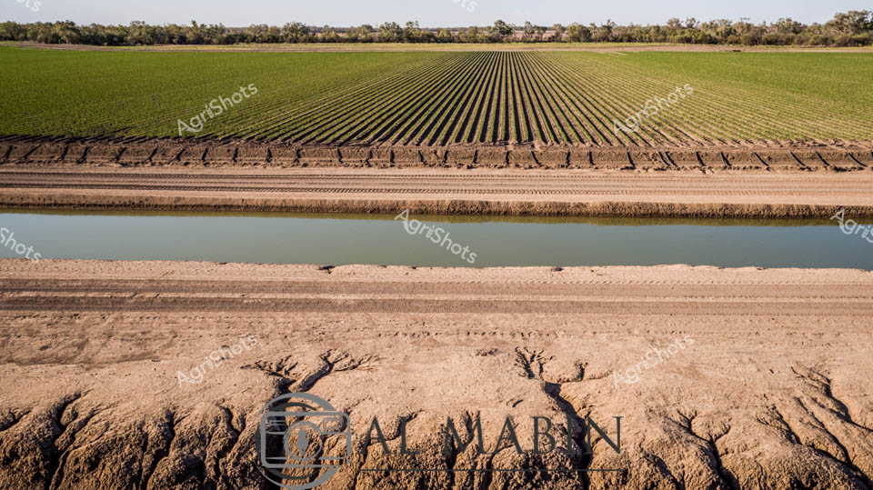
Precision agriculture unfolds across the fertile plains of New South Wales, where meticulously planted cotton rows stretch toward the horizon in perfect linear symmetry. A crisp irrigation channel bisects the landscape, its tranquil water reflecting the expansive green and brown agricultural terrain, revealing the intricate choreography of modern farming. The foreground displays eroded earth banks, carved by water and agricultural engineering, demonstrating the delicate balance between cultivation and natural landscape. Verdant crop rows transition from deep emerald to lighter green hues, showcasing the progressive growth stages of a thriving cotton field. The distant treeline provides a soft, muted backdrop, emphasizing the geometric precision of human agricultural intervention. This panorama captures the essence of Australian agricultural innovation - where carefully managed water resources, strategic land use, and advanced farming techniques transform arid landscapes into productive agricultural ecosystems.
 Image
Emerald fields unfurl beneath a John Deere tractor, its brilliant green chassis gleaming against the structured rows of a meticulously cultivated agricultural landscape. Precision agricultural technology sweeps across the crop, with an expansive spraying implement extending from the tractor's rear, delivering targeted irrigation or crop treatment with mechanical grace. The 'OVERSIZE' warning plate signals the substantial scale of modern farming equipment, highlighting the industrial might required to nurture these verdant agricultural plains. Soft dust and moisture drift through the regimented plant rows, creating a ethereal haze that speaks to the delicate balance of water, soil, and technological intervention in contemporary farming practice. Golden morning or late afternoon light bathes the scene, casting long shadows and emphasizing the geometric perfection of the planted fields - a testament to the calculated science and artistry of Australian agricultural innovation. The tractor moves with purposeful momentum, representing the backbone of rural productivity in regions like New South Wales' expansive cotton-growing districts.
 Image
Liquid gold spills across the horizon, transforming a precision irrigation canal into a mirror of molten light. At the day's final moments, the landscape near Walgett in New South Wales unfolds in a breathtaking agricultural tableau, where carefully engineered water channels slice through expansive cotton and cropping fields. The setting sun ignites the sky in passionate oranges and soft purples, casting a perfect reflection on the still water's surface, revealing the intricate relationship between agricultural infrastructure and the natural environment. Poly pipe embankments frame the canal with geometric precision, demonstrating the calculated engineering required to nurture crops in this challenging rural terrain. The panorama captures the essence of agricultural resilience - a carefully managed landscape where human intervention and natural beauty converge in harmonious symmetry. As twilight descends, the scene speaks to the sophisticated water management strategies that sustain agricultural productivity in the arid regions of northern New South Wales.
 Image
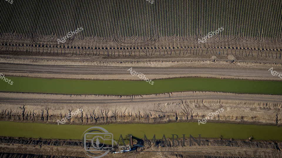
Aerial view of a meticulously engineered agricultural landscape near Walgett, New South Wales, revealing the intricate precision of modern cotton irrigation. Geometric green and tan strips alternate in a rhythmic pattern, with carefully laid poly pipes tracing linear channels across the arid terrain. The landscape speaks to the sophisticated water management strategies essential in Australia's challenging agricultural regions, where every drop of water is strategically channeled to nurture cotton crops. Stark brown earth contrasts with vibrant green zones, highlighting the delicate balance between cultivation and natural landscape. Mechanical infrastructure punctuates the scene, with industrial irrigation equipment positioned to maximize crop potential in this challenging dryland environment. The image captures the resilience and technological innovation of Australian cotton farmers, who transform seemingly inhospitable terrain into productive agricultural zones through precise engineering and water conservation techniques.
 Image
Twilight cascades across the irrigated cotton fields of Walgett Shire, casting a molten gold and lavender horizon. A solitary bovine pauses in the central irrigation channel, creating gentle concentric ripples that mirror the luminous sky. The precise agricultural landscape reveals meticulously leveled fields - deep green cotton crops contrasting against the silvery-grey irrigation channel lined with poly pipe infrastructure. Late afternoon sunlight transforms the water's surface into a liquid mirror, reflecting billowing clouds and the soft gradients of approaching evening. A lone animal drinks peacefully, symbolizing the delicate relationship between livestock, agricultural systems, and the harsh yet beautiful Australian rural environment. The scene captures the rhythmic precision of modern cotton farming - where engineered water management and natural landscape converge under the expansive NSW sky.
 Image
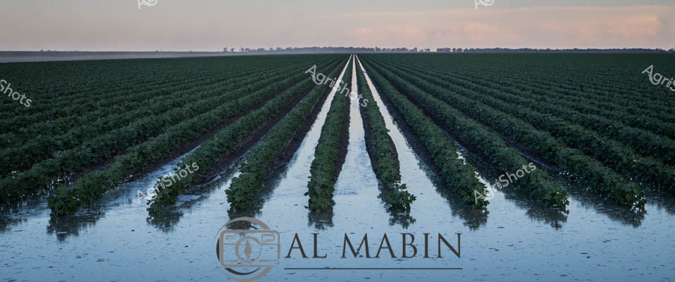
Verdant cotton rows stretch toward the horizon, perfectly aligned in a mesmerizing agricultural landscape. Precise flood irrigation floods the narrow channels between each meticulously planted row, reflecting the soft dawn light and creating a mirror-like surface that doubles the geometric precision of the planting. The lush green cotton plants stand uniform and healthy, signaling a promising crop cycle in what appears to be a prime agricultural region of New South Wales. Soft pastel skies blend from pale pink to muted blue, suggesting early morning conditions ideal for agricultural work before the intense heat of the day. The waterways between rows demonstrate sophisticated irrigation techniques, with poly pipes carefully managing water distribution to ensure optimal moisture for each plant.
 Image
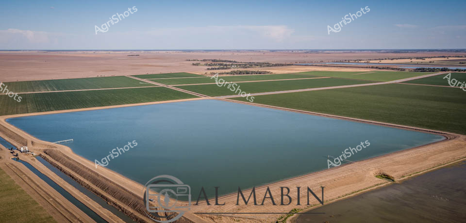
Expansive agricultural reservoir nestled in the heart of New South Wales' Walgett Shire, a testament to innovative water management in arid Australian farming landscapes. This meticulously engineered water storage basin captures the essence of modern agricultural resilience, its geometric blue expanse contrasting sharply with the surrounding golden-brown and emerald green crop fields. Precision-lined embankments frame the reservoir, demonstrating sophisticated irrigation infrastructure that transforms challenging dryland terrain into productive agricultural real estate. Radiating outward from the water source, carefully surveyed and geometrically precise crop paddocks showcase the systematic approach of contemporary farming - a patchwork of green and tan representing carefully selected crops likely including cotton, wheat, or sorghum. The expansive aerial perspective reveals the immense scale of agricultural operations in this region, where water is the most precious resource and every drop is carefully captured, managed, and distributed. The clear blue sky and uniform horizon emphasize the strategic human intervention that makes agriculture possible in these demanding environmental conditions.
 Image
A verdant cotton field stretches beneath a dramatic twilight sky in rural New South Wales, where agricultural precision meets natural beauty. A gleaming John Deere tractor sits poised along an irrigation channel, its brilliant green and yellow livery standing in stark contrast to the soft blues and greys of the approaching evening. Poly pipes snake alongside the water channel, delivering essential irrigation to the meticulously planted crop rows that extend to the distant horizon. The landscape embodies the sophisticated agricultural engineering of modern Australian farming - a delicate balance of technological intervention and natural growth. Soft clouds drift overhead, casting subtle shadows across the fertile landscape, while the tractor suggests constant readiness and the perpetual work of nurturing crops. The scene captures a moment of quiet anticipation, where the day's labor meets the promise of future harvest, reflecting the resilience and technical mastery of Australian agricultural practices.
 Image
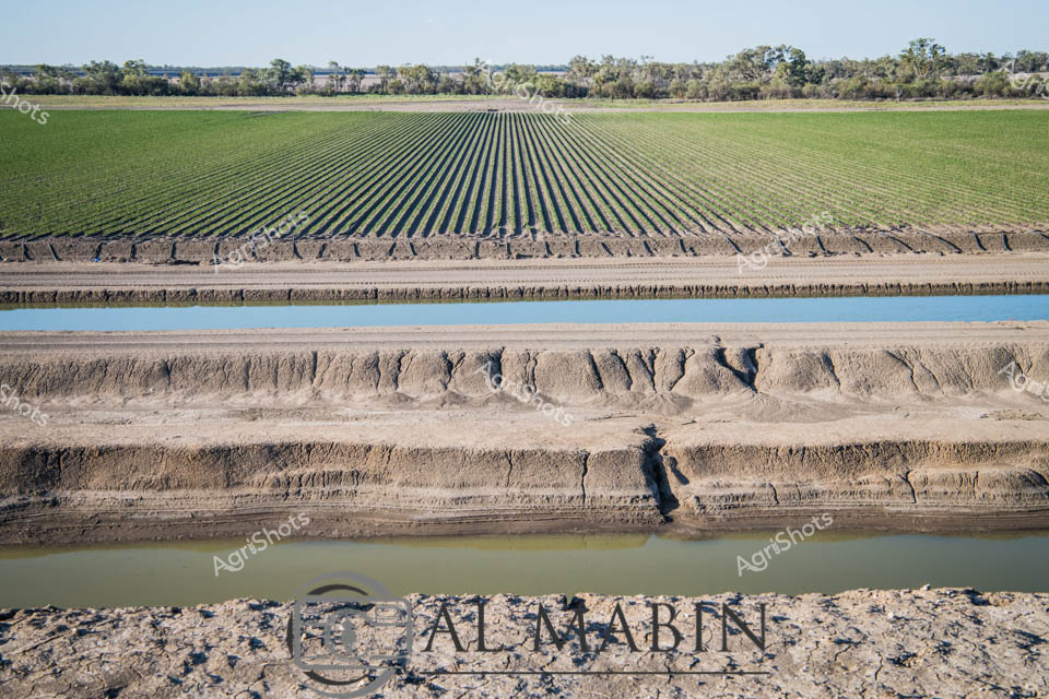
Precision irrigation carves a geometric landscape near the cotton fields of inland New South Wales. Deep water channels slice through parched earth with engineered perfection, creating razor-sharp lines between dusty banks and azure water surfaces. Meticulously planted rows of vibrant green crops stretch toward distant tree lines, demonstrating agricultural mastery over arid terrain. The water channels - likely fed by poly pipe systems - reveal the critical infrastructure supporting crop survival in a challenging agricultural environment. Erosion patterns along the channel walls tell a story of water's persistent power, with each carved groove a testament to hydraulic engineering and careful water management. The panorama captures the delicate balance between human agricultural intervention and natural landscape, where every measured water channel represents survival and productivity in the Australian agricultural context.
 Image
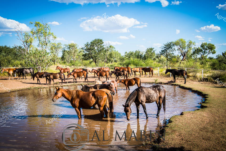
Windswept horses converge at a sunlit water hole, their muscular bodies glistening in the bright Western Australian pastoral landscape. Rich chestnut, deep black, and dappled grey horses stand partially submerged, drinking from the clear dam surrounded by sparse eucalyptus and grassland vegetation. The herd represents a classic station scene - robust stock horses cooling themselves during the heat of the day, their reflections mirroring in the tranquil water against a backdrop of cloudless azure sky. Fencing defines the paddock's boundaries, suggesting this is a carefully managed pastoral property where these powerful animals gather to hydrate and rest. The mid-morning light casts warm tones across the dusty earth and creates sharp contrasts between the horses' coats and the reflective water surface. This quintessential Australian rural scene captures the raw beauty of horse management in the expansive agricultural landscapes of Western Australia, where water sources are critical lifelines for livestock.
 Image
Limestone-rich terra rossa soil reveals its distinctive rusty red layers in this compelling agricultural close-up from a South Australian vineyard. Vibrant green grape vine leaves cascade across the exposed soil profile, highlighting the intricate geological composition that defines the region's renowned wine-growing terroir. The reddish-brown earth displays complex stratification, with varying textures and mineral concentrations that speak to generations of geological transformation and agricultural cultivation. The layered soil cross-section provides a rare glimpse into the underground environment that nourishes and supports grape cultivation, showcasing the remarkable intersection of geological history and agricultural practice. Bright, fresh grape foliage contrasts beautifully against the rich, earthy tones, capturing the dynamic relationship between living vegetation and the ancient ground from which it emerges.
 Image
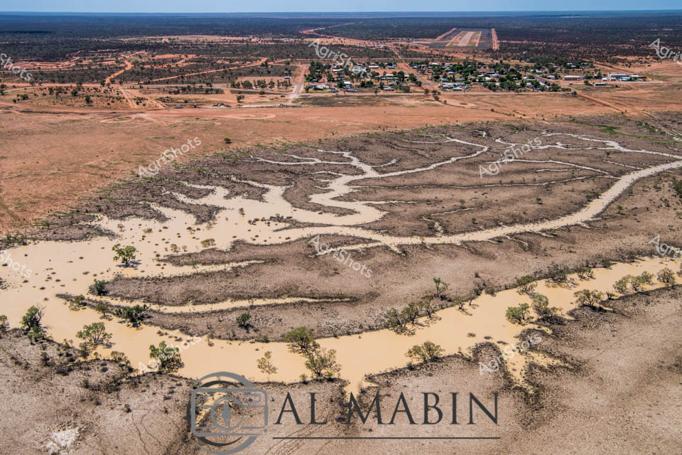
Aerial view of The Channel Country landscape near Windorah, Queensland, revealing the intricate dry riverbed and flood patterns of an arid pastoral region. The serpentine waterway winds through a dusty, ochre-toned landscape, its sandy banks punctuated by sparse, resilient eucalyptus trees that mark the natural contours of the creek system. In the distance, a small rural settlement clusters near a long airstrip, a lifeline for this remote beef cattle station where infrastructure is as sparse as the vegetation. The image captures the raw beauty of Australia's inland territories - a terrain sculpted by intermittent water flows, where each rare flooding event transforms the parched earth into a complex network of temporary rivers and channels. Subtle variations of tan, russet, and pale gold dominate the palette, highlighting the subtle textures of weathered ground and the delicate branching patterns of the dried watercourse. This landscape speaks to the resilience of Australian pastoral communities, who survive and thrive in one of the world's most challenging agricultural environments.
 Image
White and blue caravans and utility vehicles cluster beneath the gnarled tree branches, providing mobile shelter and support for the cattle handlers. The dry, sun-bleached landscape speaks to the challenging conditions of stock route travel, where herds are moved across vast agricultural territories. Several horses and vehicles suggest a working team paused during the day's droving activities, with the harsh midday sunlight casting sharp shadows across the weathered terrain. The scene captures the timeless rhythm of livestock transport - a moment of rest and regrouping amidst the demanding work of moving cattle across the expansive Australian countryside. Muted earth tones of brown, grey, and blue create a serene yet industrious atmosphere, reflecting the resilience and practical ingenuity of rural agricultural workers.
 Image
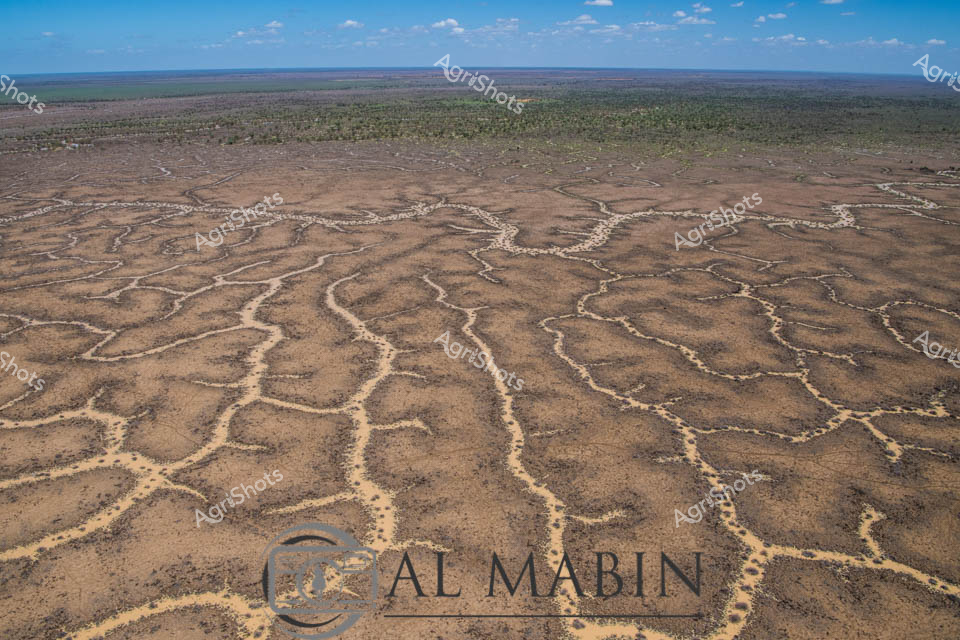
Aerial view of Channel Country, Queensland, revealing nature's intricate water management system. Serpentine channels carved into the arid landscape create a mesmerizing network of dry creek beds and ephemeral waterways, stretching across a vast, undulating terrain. The intricate patterns resemble delicate veins etched into the earth's surface, a testament to the power of water in shaping this harsh desert environment. Sparse vegetation clusters around the edges of these natural channels, hinting at the resilience of life in this challenging ecosystem. The landscape transitions from rich brown earth in the foreground to muted greens and distant horizons, under a soft blue sky dotted with wispy clouds. This image captures the raw beauty of Australia's inland water systems, showcasing how even in the driest conditions, water finds its path across the landscape, creating lifelines for the region's unique flora and fauna.
 Image
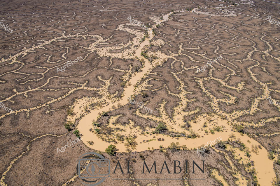
An intricate aerial view of a meandering waterway carving through arid Channel Country in Queensland, revealing the complex hydrology of a flood plain. Sandy-colored water branches across the landscape in sinuous channels, creating an organic network of waterways lined with sparse vegetation and surrounded by rich, textured earth tones. The image captures the ephemeral nature of water in this remote Australian landscape, highlighting the delicate ecological systems of inland river systems.
 Image
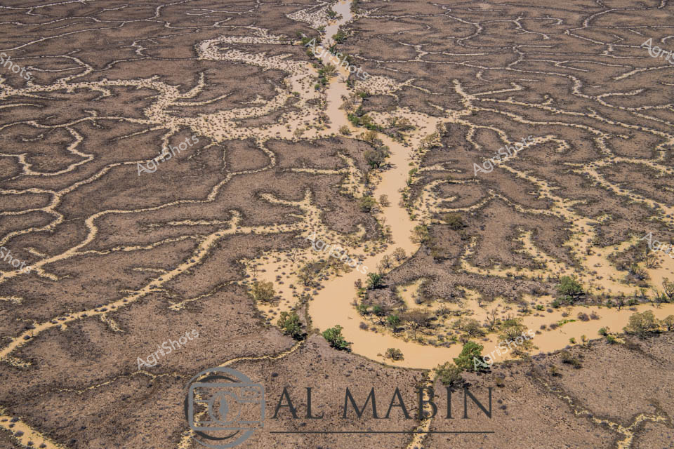
Ephemeral waterways snake through the arid Channel Country landscape, revealing the intricate hydrology of Queensland's remote beef station country. A sinuous muddy river winds between complex fractal patterns of dry earth and sparse vegetation, capturing the dramatic seasonal transformation of this harsh inland region. Windorah's characteristic terrain displays a delicate network of eroded channels and raised earth formations, testament to generations of pastoral adaptation in an unforgiving environment. Scattered native scrub and saltbush punctuate the brown and ochre terrain, highlighting the resilient ecosystem that supports extensive cattle grazing operations. The aerial perspective unveils the sophisticated natural irrigation patterns that define this unique Australian landscape, where water becomes a precious, sculpting force across hundreds of kilometers of remote pastoral land. The waterway's murky brown tone suggests recent flooding, a critical event that replenishes groundwater and triggers complex ecological renewal in this challenging agricultural frontier.
 Image
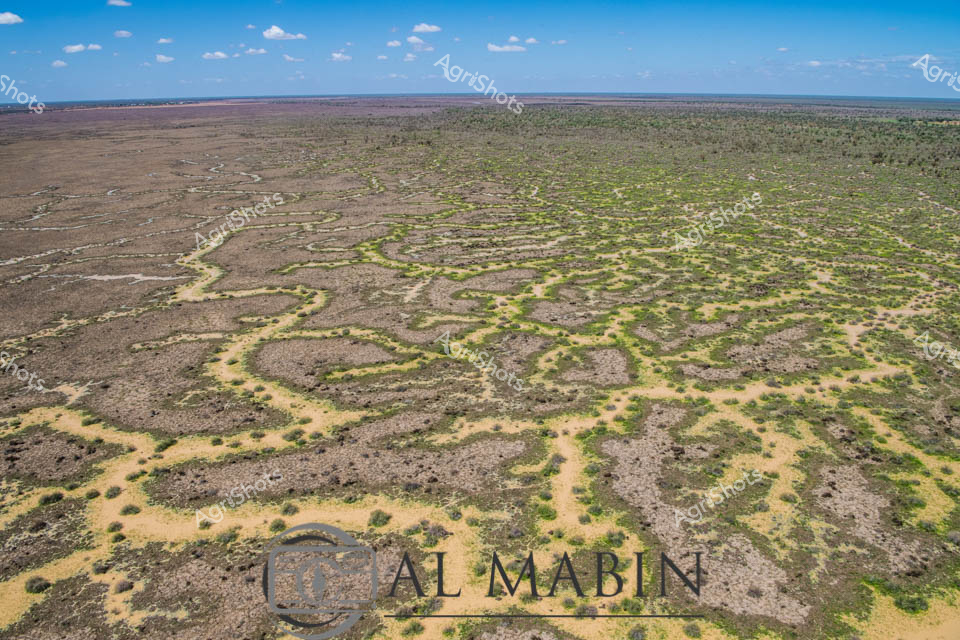
Aerial view of station in Queensland's Channel Country, revealing an intricate natural water management system carved into the arid landscape. Sinuous yellow-edged channels wind through grey-brown terrain, creating an organic, almost fractal-like pattern of water distribution across the semi-arid grasslands. Sparse vegetation in muted greens and yellows punctuates the rocky ground, demonstrating the resilience of vegetation in this challenging ecosystem. The expansive horizon stretches beneath a soft blue sky dotted with wispy white clouds, highlighting the immense scale of this pastoral landscape. This sophisticated natural irrigation network represents the remarkable adaptation of vegetation and land formations in Australia's harsh interior, where water is a precious and strategic resource for cattle stations and indigenous ecosystems. The photograph captures the subtle beauty of inland Queensland, where geological processes and sparse rainfall create stunning, functional landscapes that sustain livestock and wildlife.
 Image
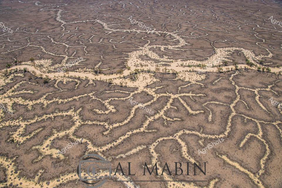
Aerial view of The Channel Country, revealing the intricate network of ephemeral waterways that define this remarkable Queensland landscape. Serpentine channels of pale sand weave through dark earth, creating a mesmerizing natural pattern that resembles delicate river veins across the arid terrain. Sparse vegetation of muted yellows and greens punctuates the landscape, highlighting the resilience of life in this harsh environment. The waterways, etched by seasonal floods, showcase the dynamic hydrology of Australia's inland river systems, where water becomes a transformative force shaping the landscape. These braided channels are critical to the survival of beef cattle stations, providing essential water resources and creating unique grazing corridors in the remote outback. The image captures the raw, elemental beauty of Queensland's remote interior, where water's intermittent presence sculpts a living, breathing geographical masterpiece.
 Image
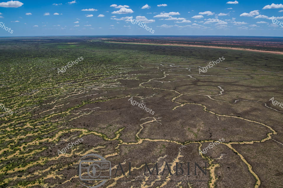
Aerial expanse of Channel Country in western Queensland reveals nature's extraordinary irrigation network. Intricate waterways trace delicate, serpentine patterns across the arid landscape, creating a complex network of seasonal creek channels that transform the dry terrain during flood events. The natural hydraulic system spreads across muted earth tones - deep charcoal greys, olive greens, and dusty yellows - demonstrating the remarkable adaptation of Australia's inland ecosystems. Sparse vegetation clusters around the water channels, highlighting the resilience of plant life in this challenging environment. Expansive blue skies with scattered white clouds provide a luminous backdrop, emphasizing the immense scale of this remote pastoral region. This landscape represents the vital water management systems that sustain livestock production in some of Australia's most demanding agricultural territories, where strategic water distribution can mean survival for cattle stations spanning thousands of hectares.
 Image
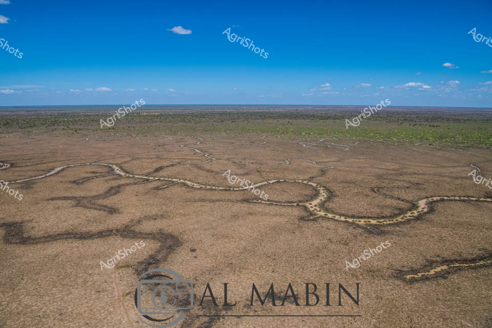
Serpentine waterways carve intricate patterns across the arid landscape of Queensland's Channel Country, revealing the delicate lifelines that sustain pastoral ecosystems during rare flooding events. This aerial perspective captures the sinuous water channels spreading like silver veins across the sun-baked earth, transforming the typically dry terrain into a complex network of moisture and potential regeneration. The stark contrast between the rich blue sky and the muted browns and greens of the landscape highlights the resilience of this remote Australian pastoral environment, where water is the most precious resource. Windorah's distinctive riverine topography demonstrates nature's remarkable capacity to create complex hydrological systems that support livestock production and fragile dryland ecosystems. The meandering channels, likely formed by seasonal river flows, showcase how strategic water management is crucial in beef production across Queensland's challenging inland regions. This image encapsulates the raw beauty of Australia's agricultural frontier, where every drop of water represents survival and potential for pastoral sustainability.
 Image
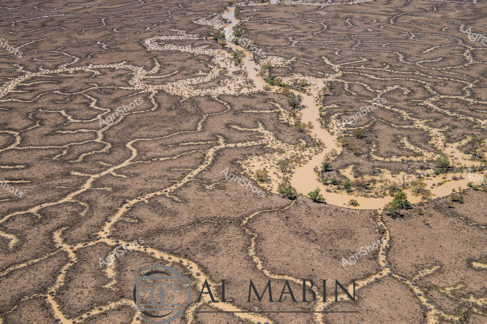
The captures the mesmerizing topology of Channel Country in western Queensland, revealing an extraordinary aerial perspective of braided waterways carving intricate patterns across an arid landscape. The sinuous, serpentine channels of pale sandy sediment wind like delicate veins across the brown earth, tracing the ephemeral pathways of seasonal floodwaters through this remote pastoral region. Sparse, resilient vegetation clusters along the watercourses, creating small islands of green against the monochromatic terrain, highlighting the remarkable adaptability of life in this harsh environment. The aerial view exposes the complex hydrology of the landscape, where every subtle elevation change guides water's meandering journey across the flat expanses of a cattle station. These natural irrigation networks, formed over millennia, are critical lifelines for livestock and native ecosystems in one of Australia's most unforgiving landscapes. The image beautifully illustrates the geological artistry of water movement, transforming what might appear barren into a delicate, living cartography of survival and connection.
 Image
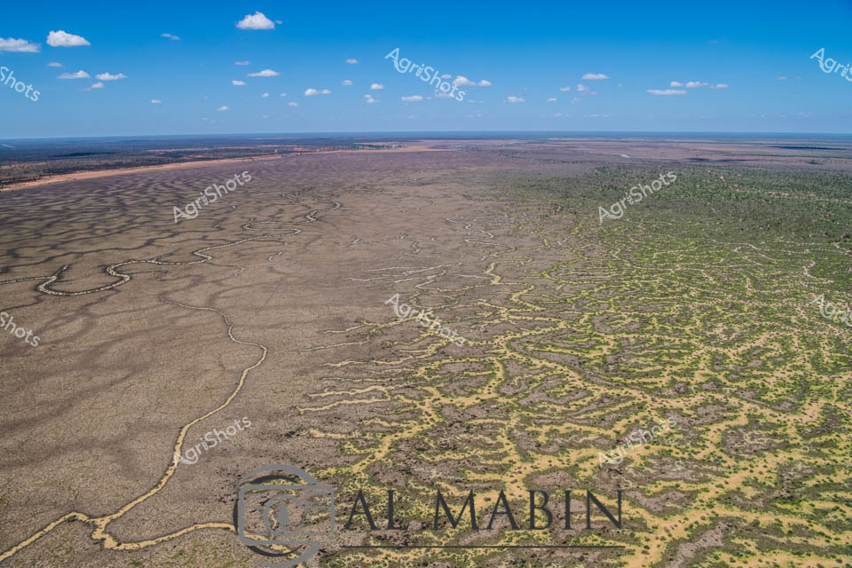
Aerial vista of Channel Country's mesmerizing landscape near Windorah, Queensland, revealing the intricate hydraulic networks carved by seasonal floodwaters across an expansive arid terrain. Serpentine waterways branch and meander through the dusty ochre plains, creating complex dendritic patterns that pulse with life-giving moisture across the seemingly barren landscape. The image captures the extraordinary resilience of Australia's inland geography, where ephemeral creek systems transform dry grasslands into temporary wetlands during rare flooding events. Subtle gradations of brown, tan, and muted green reveal the delicate ecological balance of this harsh yet breathtaking environment, where water is the critical architect of survival. Wispy clouds drift across a brilliant azure sky, providing a luminous backdrop to the textured ground below, highlighting the dramatic contrast between aridity and potential abundance. This landscape epitomizes the dramatic seasonal transformations of Queensland's remote beef station country, where water's momentary presence sculpts the very essence of the terrain.