About this image
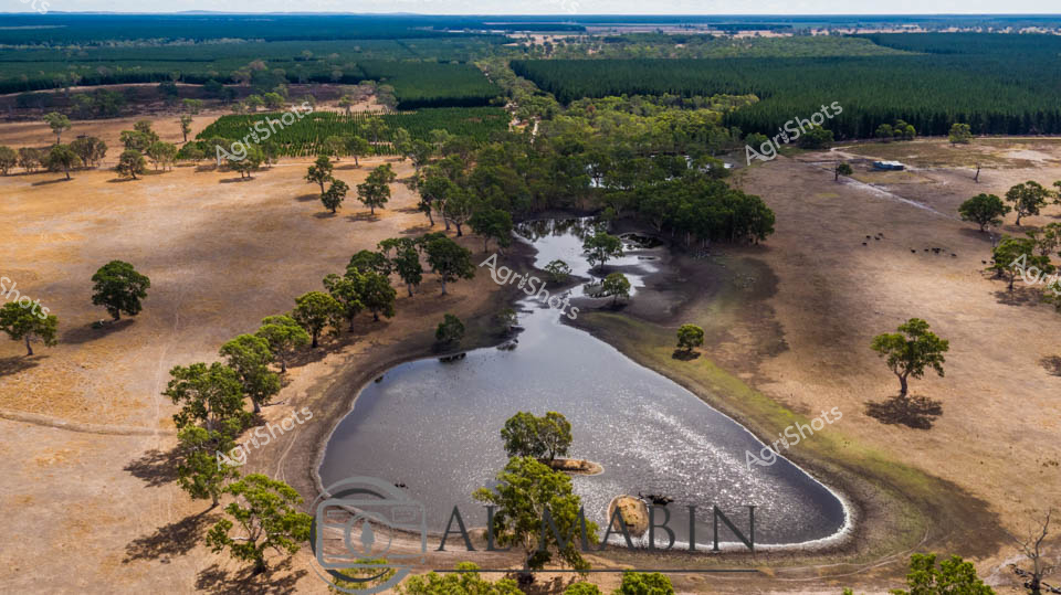
Aerial view of a serpentine water dam nestled among scattered eucalyptus trees in a dry pastoral landscape. The silvery water body curves like a liquid serpent, reflecting brilliant sunlight and surrounded by parched golden grasslands typical of South Australian agricultural terrain. Dense green tree clusters punctuate the brown earth, offering shade and windbreaks across the expansive farmland. Dark green pine plantations line the distant horizon, creating a stark contrast with the weathered paddocks in the foreground. The dam provides critical water infrastructure for livestock and agricultural operations, a lifeline in this arid region where water management is crucial for sustainable farming. The aerial perspective reveals the intricate relationship between natural landscape and agricultural intervention, showcasing how farmers carefully design water resources to support rural productivity in challenging environmental conditions.
Similar media
 Image
Image
Aerial survey of a remote Queensland cattle station, revealing the lifeblood of pastoral enterprise - water management. A serpentine waterhole curves through the arid landscape, its green-tinged waters reflecting the sparse eucalyptus woodland and rust-red earth typical of Australia's northern cattle country. The dam, strategically positioned to sustain livestock during harsh dry seasons, sits nestled among weathered gum trees and rocky terrain, showcasing the resilience of agricultural infrastructure in challenging environments. Surrounding paddocks stretch toward the horizon, punctuated by subtle variations in vegetation that hint at careful land management practices. The muted palette of ochre, sage, and slate blue captures the unforgiving beauty of the Australian outback, where every water source is a critical resource for cattle stations supporting the nation's vital beef production. This expansive vista epitomizes the intersection of natural landscape and agricultural sustainability, a testament to generations of pastoral expertise in transforming marginal lands into productive agricultural systems.
 Image
Image
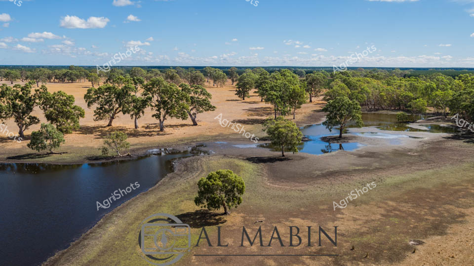
Expansive pastoral landscape at station, where drought-affected grasslands converge with scattered eucalyptus woodlands and a diminishing water reservoir. Weathered gum trees cast long shadows across parched earth, their robust forms punctuating the golden-brown terrain and offering sparse relief from the unforgiving Australian landscape. Shallow water pools reflect the brilliant blue sky, revealing the stark contrast between water scarcity and abundant sunlight characteristic of the region's challenging agricultural conditions. The dam's receding shoreline exposes cracked soil, highlighting the environmental resilience required of South Australian farmers during prolonged dry seasons. Soft white clouds drift across an endless horizon, providing a serene backdrop to this quintessential rural scene that speaks to the complex relationship between land, water, and survival in the arid agricultural heartlands.
 Image
Image
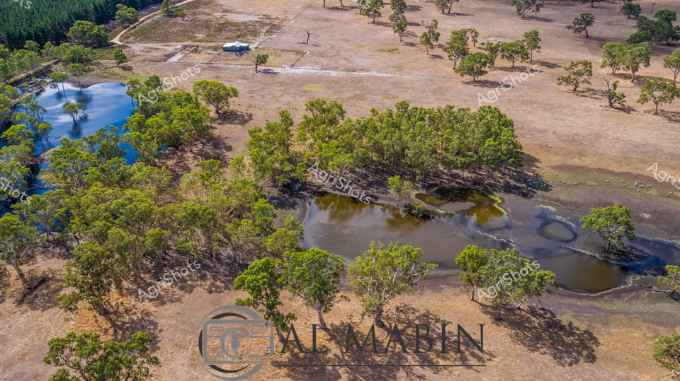
Dry season aerial view of a pastoral landscape in South Australia, revealing the resilient character of rural farming terrain. Scattered gum trees cast long shadows across parched paddocks, their verdant green canopies contrasting sharply with the sun-bleached earth. Strategically placed water bodies - a mix of blue and muddy green dams and waterholes - provide critical lifelines for livestock and agricultural sustainability in this arid environment. Mature trees cluster around water sources, creating natural windbreaks and sheltered zones that protect against harsh environmental conditions. The overhead perspective captures the intricate mosaic of Australian agricultural landscape - a testament to farmers' adaptability and connection to the challenging yet beautiful inland terrain.
 Image
Image
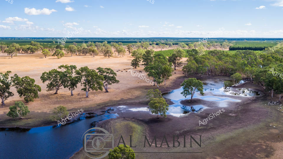
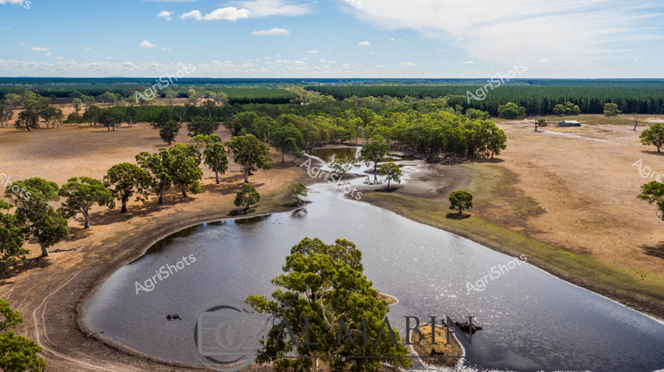
Limestone-studded creek lines meander through a classic South Australian pastoral landscape, revealing the delicate hydrology of an expansive dryland farming property. Weathered river red gums stand sentinel across parched golden grasslands, their gnarled branches casting long shadows over blue-tinted water pools. The dam's irregular shoreline demonstrates the challenging water management crucial to agricultural survival in this arid region, with exposed muddy banks suggesting recent drought conditions. Scattered mature eucalypts provide critical shade and windbreak infrastructure, their robust forms a testament to generations of careful landscape stewardship. The panoramic vista stretches toward distant tree lines and structured agricultural plantations, highlighting the intricate balance between natural ecosystem and cultivated land. Soft cumulus clouds drift across a luminous azure sky, offering a sense of atmospheric respite in this sun-drenched agricultural terrain. The landscape speaks of resilience - a quintessential Australian pastoral scene where water resources, carefully harvested and preserved, sustain both livestock and agricultural productivity through challenging seasonal transitions. This aerial perspective captures the nuanced relationship between land, water, and human agricultural intervention.
 Image
Image
Expansive pastoral landscape revealing the resilient heart of South Australian agricultural terrain. A serpentine water reservoir curves through drought-stressed paddocks, surrounded by mature eucalyptus and river red gums standing sentinel across golden-brown grasslands. The dam's reflective surface provides critical water resources for livestock and agricultural operations, its strategic placement supporting the surrounding farming ecosystem. Distant forest lines and scattered trees create a textural mosaic of green and bronze, illustrating the challenging yet adaptive nature of rural agricultural landscapes during dry seasonal conditions. Soft cumulus clouds drift across a luminous blue sky, offering a sense of hope and potential renewal to the parched earth below. The panoramic view captures the essential interplay between water management, land use, and environmental sustainability that defines modern Australian agricultural practice.
 Image
Image
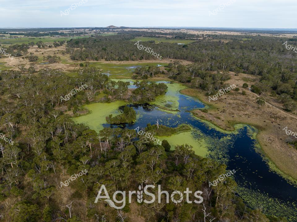
Verdant wetlands wind through a classic Victorian pastoral landscape, a vibrant ecosystem nestled amid eucalyptus woodlands and open grazing plains. The serpentine waterway, lush with emerald algae and deep blue channels, meanders through dense stands of pale-barked gum trees, creating a complex habitat rich with biodiversity. Surrounding farmlands stretch to the distant horizon, revealing the subtle patchwork of agricultural development and preserved natural terrain that characterizes this region's agricultural heritage. Marsh grasses and aquatic vegetation create intricate patterns across the water's surface, suggesting a thriving ecosystem that supports both wildlife and pastoral farming practices. The aerial perspective captures the delicate balance between managed agricultural land and preserved natural environments, showcasing Victoria's nuanced landscape management. Soft blue skies and varied green and brown tones communicate the subtle seasonal transitions of the Australian rural ecosystem, highlighting the interconnected nature of farming and natural landscapes.
 Image
Image
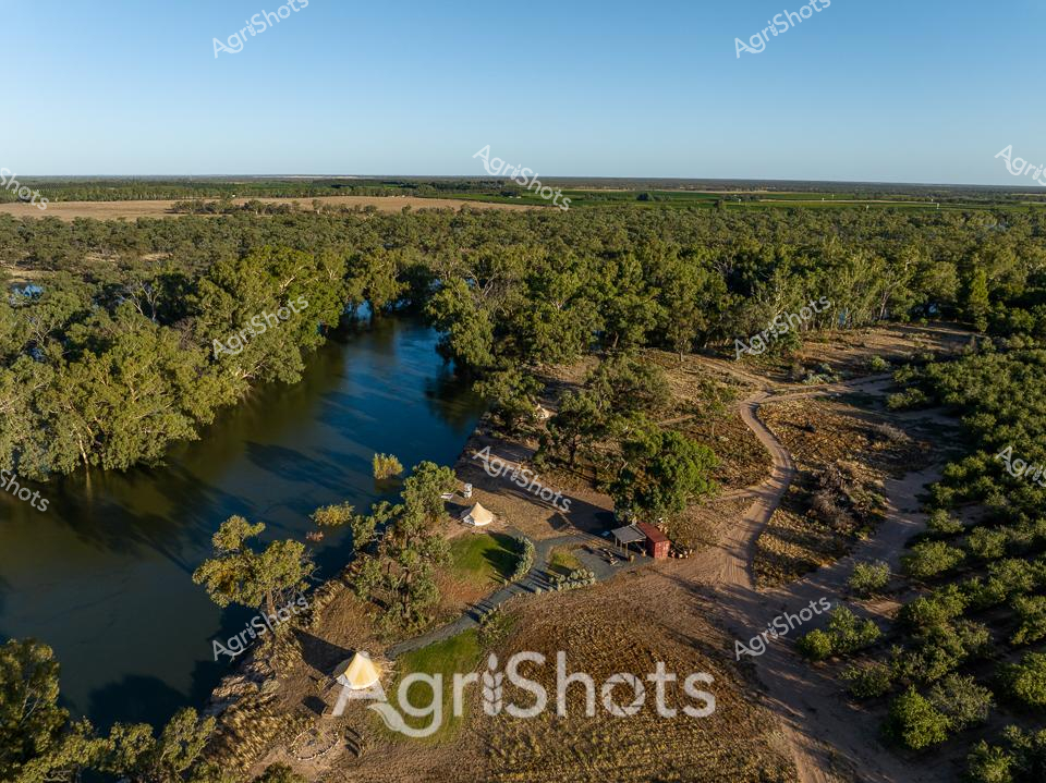
Aerial view of a serene riverside agricultural property nestled in the lush woodland landscape of regional New South Wales. A winding blue river meanders through dense eucalyptus forest, creating a verdant corridor beside a carefully positioned homestead. Rustic farm buildings, including a white tent and weathered red shed, are strategically situated on a cleared area near the water's edge, reflecting generations of strategic rural settlement. Dusty dirt tracks wind through the surrounding bushland, connecting different areas of the property and revealing the complex topography of this agricultural landscape. The golden morning light bathes the scene in warm tones, highlighting the rich green of the tree canopy and the dark blue of the river's surface, capturing the quintessential Australian rural environment in its pristine early morning tranquility. This image encapsulates the harmony between agricultural development and natural landscape, showcasing the resilience and thoughtful land management of Australian farmers.
 Image
Image
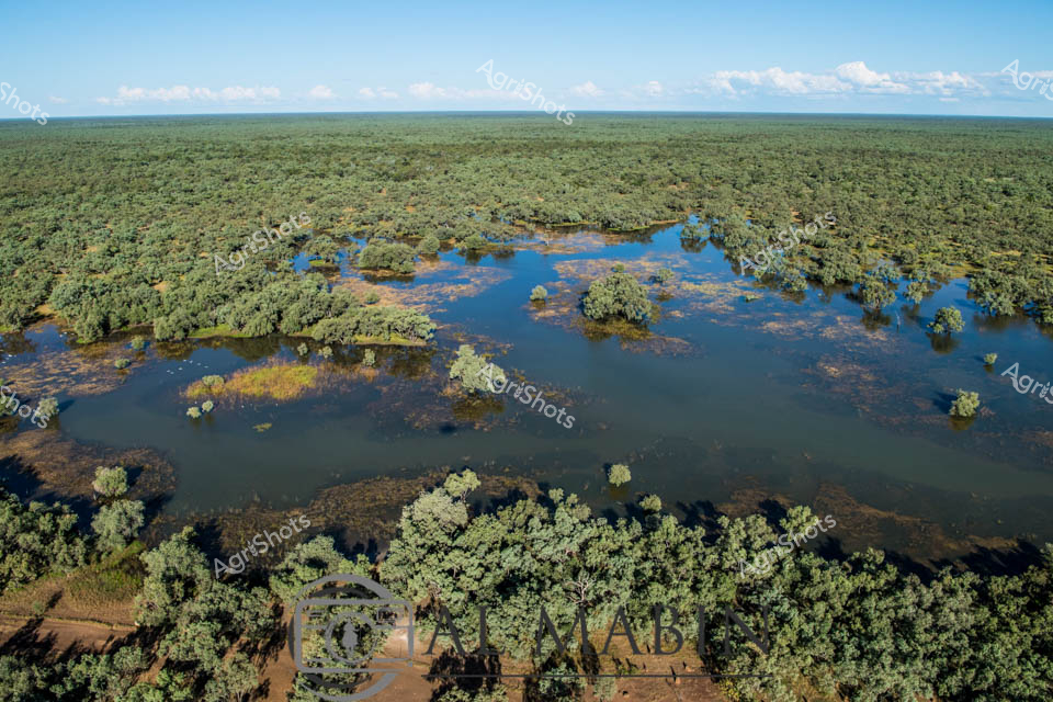
Aerial panorama of a classic Top End floodplain during the wet season, revealing the lush, inundated landscape of a remote Northern Territory cattle station. Expansive blue-green waters weave through dense eucalyptus woodland, creating a complex mosaic of submerged trees and seasonal wetlands characteristic of the region's tropical savanna ecosystem. The waterlogged terrain showcases the dramatic seasonal transformation of the landscape, where thousands of hectares become temporarily converted into a shallow, tree-studded inland sea. Soft cumulus clouds drift across a cerulean sky, highlighting the immense horizontal scale of this pristine wilderness. Glimpses of a dirt track in the foreground suggest the challenging access and remote nature of these vast pastoral lands. The image captures the dynamic hydrology of Australia's northern landscapes, where annual monsoon rains dramatically reshape the environment, supporting rich biodiversity and sustaining cattle operations across immense, seemingly untouched territories.