
About this image
Aerial vista of Channel Country's ephemeral waterways near Windorah, Queensland, revealing the intricate capillary-like network of seasonal creek systems during a rare flooding event. Silvery-white water tendrils fracture the ochre and umber landscape, tracing delicate branching patterns across the arid terrain like living arteries. The main watercourse glows with a burnished golden-brown hue, carrying life-giving moisture through the parched plains, with sparse vegetation clinging to its edges in resilient clusters of olive and sage green. This extraordinary landscape demonstrates the transformative power of water in Australia's harsh interior, where brief moments of abundance reshape the seemingly dormant ecosystem. The complex hydrological system illustrates the remarkable adaptation of beef stations in Queensland's remote Channel Country, where pastoral management relies on understanding these dynamic, intermittent water flows. From this elevated perspective, the landscape appears almost abstract - a stunning natural cartography of survival and renewal in one of the world's most challenging agricultural environments.
Similar media
 Image
Image
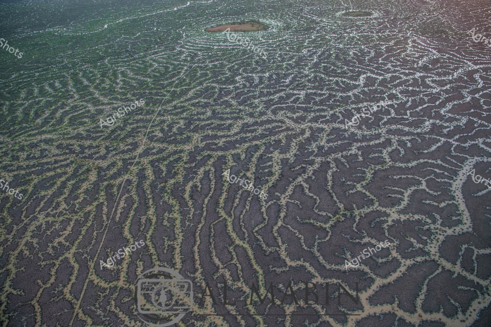
Aerial view of intricate water channels spreading across an arid Queensland landscape, capturing the mesmerizing patterns of flood irrigation in Channel Country. Sinuous lines of water weave through dark and green-tinted earth, creating a natural labyrinth that resembles delicate veins across the barren terrain. The complex network of waterways reveals the transformative power of seasonal flooding, where ephemeral rivers and creeks spread nutrients and moisture across the harsh outback landscape. Subtle gradients of green, brown, and grey blend together, showcasing the delicate balance of water management in Australia's remote beef production regions. This extraordinary perspective highlights the resilience of pastoral landscapes, where strategic water distribution enables livestock grazing in some of the continent's most challenging environments. The image captures the raw beauty of Queensland's inland hydrology, where every water channel represents a lifeline for agricultural survival in an unforgiving ecosystem.
 Image
Image
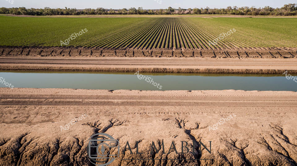
Precision-engineered agricultural landscape reveals the intricate relationship between water, soil, and cultivation in Australia's expansive Channel Country. Geometrically perfect crop rows stretch across the horizon, transitioning from deep emerald to lighter green, bisected by a precisely engineered irrigation channel filled with soft, reflective water. The foreground displays eroded earth textures, revealing the challenging terrain's complex topography - carved channels and mineral-rich sedimentary patterns tell a story of water's transformative power across this arid landscape. Laser-straight irrigation channels demonstrate sophisticated farming techniques adapted to Queensland's harsh environmental conditions, where every drop of water is strategically channeled to maximize agricultural productivity. The linear perspective creates a mesmerizing visual rhythm, highlighting human intervention in shaping seemingly untameable landscapes. Distant treelines provide a muted green boundary, suggesting the delicate ecological balance maintained through careful land management. This panorama captures the essence of Australian agricultural resilience - a testament to engineering, environmental understanding, and the relentless pursuit of sustainable food production in challenging terrain. The image speaks to generations of agricultural innovation, where precise water management transforms potentially unproductive landscapes into thriving agricultural ecosystems.
 Image
Image
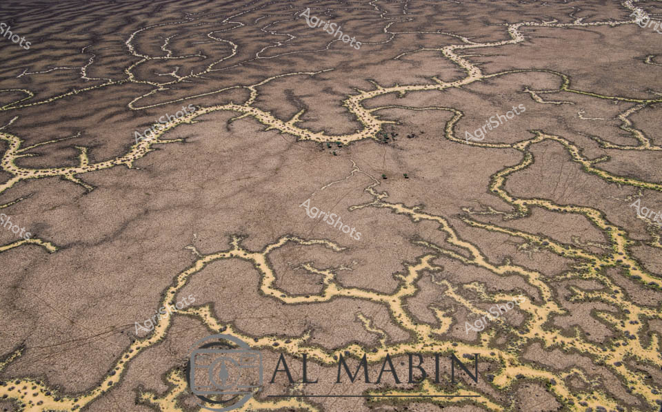
Meandering waterways carve intricate golden-edged channels across the parched earth of Queensland's Channel Country, revealing the dramatic hydrology of Australia's arid interior. Delicate ribbons of yellowed vegetation trace the ephemeral creek lines, highlighting the complex networks that carry precious water across this harsh landscape during rare flooding events. The aerial perspective transforms the landscape into an abstract topographical map, showcasing the resilient ecological patterns of inland Australia's beef station territories. Windorah's distinctive landscape emerges as a masterpiece of natural engineering, where water navigates through sun-baked terrain in serpentine patterns that speak to the region's extreme environmental conditions. These seasonal water flows are lifelines for remote pastoral operations, providing critical hydration for livestock and sustaining sparse vegetation in one of the continent's most challenging agricultural environments. The muted browns and subtle golden highlights capture the raw beauty of Queensland's inland watersheds, illustrating the delicate balance of survival in Australia's unforgiving outback.
 Image
Image
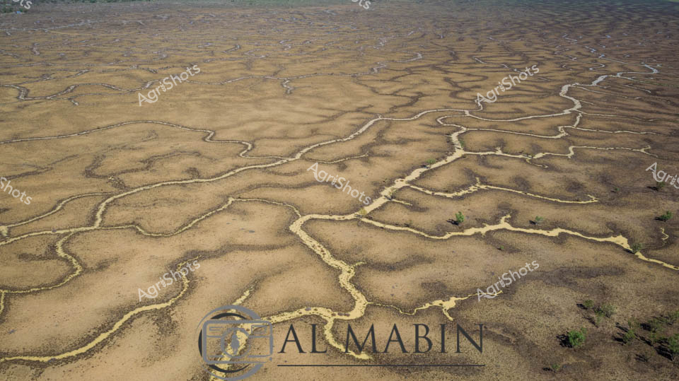
Serpentine waterways weave across a sun-baked Channel Country landscape, revealing the intricate network of ephemeral creek systems that define Queensland's arid pastoral regions. The aerial perspective captures the delicate golden and ochre tendrils of water channels meandering across the dusty earth, creating an organic, vein-like pattern that speaks to the fragile hydrology of this remote Australian terrain. Each sinuous waterway traces a path of potential life through the seemingly barren landscape, highlighting the critical importance of seasonal flooding in supporting livestock grazing and ecosystem survival in these harsh western Queensland stations. Subtle variations of tan, amber, and pale yellow create a nuanced topographical canvas, with sparse vegetation offering rare punctuations of green against the predominantly earth-toned backdrop. This image epitomizes the resilience and dynamic nature of Australian pastoral landscapes, where water is both a precious resource and a transformative geological force.
 Image
Image
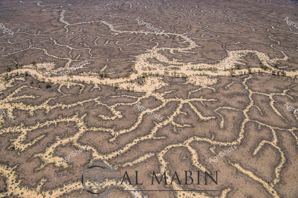
Aerial view of The Channel Country, revealing the intricate network of ephemeral waterways that define this remarkable Queensland landscape. Serpentine channels of pale sand weave through dark earth, creating a mesmerizing natural pattern that resembles delicate river veins across the arid terrain. Sparse vegetation of muted yellows and greens punctuates the landscape, highlighting the resilience of life in this harsh environment. The waterways, etched by seasonal floods, showcase the dynamic hydrology of Australia's inland river systems, where water becomes a transformative force shaping the landscape. These braided channels are critical to the survival of beef cattle stations, providing essential water resources and creating unique grazing corridors in the remote outback. The image captures the raw, elemental beauty of Queensland's remote interior, where water's intermittent presence sculpts a living, breathing geographical masterpiece.
 Image
Image
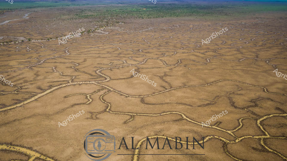
An aerial view reveals the intricate, serpentine waterways of Channel Country in Queensland, where dry creek beds and floodplains create a mesmerizing network of sinuous lines across the arid landscape. The branching water channels, etched into the dusty earth, showcase the complex hydrology of this remote Australian region, highlighting the resilient geography that supports pastoral activities during seasonal flooding. Green vegetation clusters along the horizon, contrasting with the golden-brown tones of the expansive, water-carved terrain.
 Image
Image
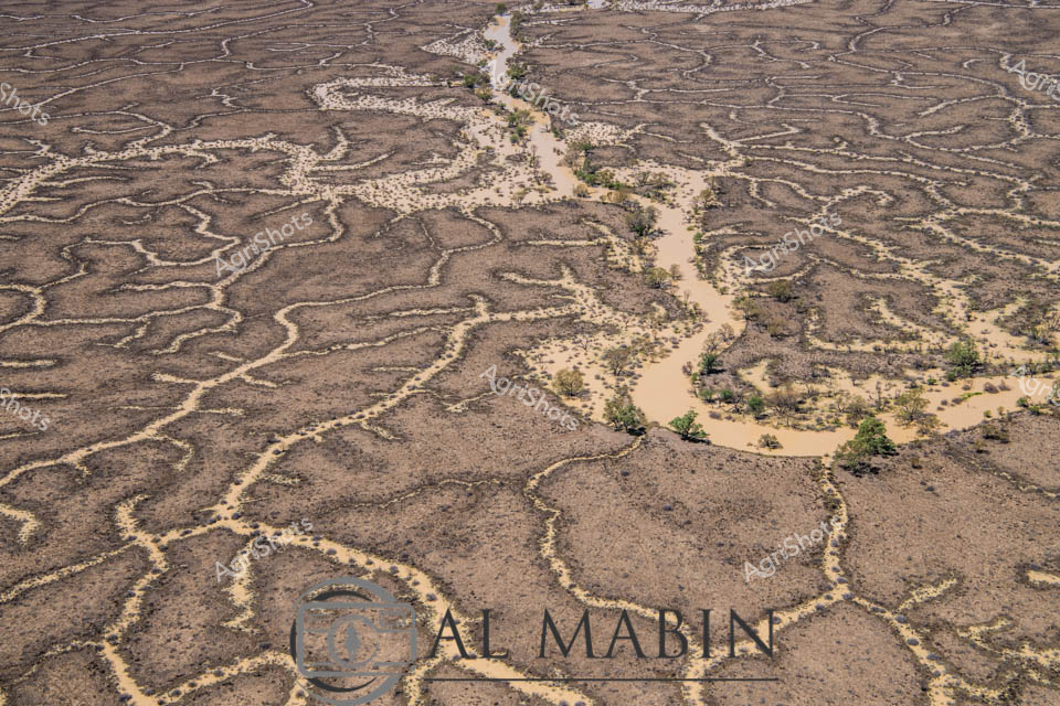
The captures the mesmerizing topology of Channel Country in western Queensland, revealing an extraordinary aerial perspective of braided waterways carving intricate patterns across an arid landscape. The sinuous, serpentine channels of pale sandy sediment wind like delicate veins across the brown earth, tracing the ephemeral pathways of seasonal floodwaters through this remote pastoral region. Sparse, resilient vegetation clusters along the watercourses, creating small islands of green against the monochromatic terrain, highlighting the remarkable adaptability of life in this harsh environment. The aerial view exposes the complex hydrology of the landscape, where every subtle elevation change guides water's meandering journey across the flat expanses of a cattle station. These natural irrigation networks, formed over millennia, are critical lifelines for livestock and native ecosystems in one of Australia's most unforgiving landscapes. The image beautifully illustrates the geological artistry of water movement, transforming what might appear barren into a delicate, living cartography of survival and connection.
 Image
Image
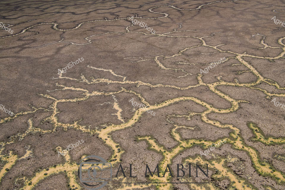
Aerial view of a braided network of water channels traversing an arid landscape, characteristic of Queensland's Channel Country. Intricate golden-yellow waterways wind and meander through a weathered grey-brown terrain, creating a natural map-like pattern that reveals the complex hydrology of this remote Australian landscape. The dry season's parched earth contrasts with the delicate veins of water, highlighting the resilience and dynamic nature of inland river systems during flood events. Subtle green vegetation edges the water channels, providing a hint of life in this otherwise stark environment. The image captures the essence of remote pastoral landscapes, where water management and seasonal flooding are critical to the survival of cattle stations and the unique ecosystem of inland Australia. This aerial perspective offers a stunning visualization of the intricate water distribution networks that define the breathtaking Channel Country region near Windorah in Queensland.